Tuesday, August 1 to Thursday, August 3, 2017 ~ MT
Glacier National Park, MT
Rough night. It’s 6:50am Mountain Time but I just drove from Pacific Time, so it is really 5:50am for me. I was up and down all night and though the cabin is locked tight, the gurgling of my own tummy scared me awake. Geez, I need to lighten up. I just don’t do well sleeping in strange places. There was a mouse scratching around in the bag that held my loaf of bread. I guess I can’t blame him but he was so loud, I wasn’t sure he was a mouse!
Still, from the desk where I write I have a view of the mountains bathed in the light of the sunrise. Free range cattle wander between the cabins with their calves. There is a chewed-up granola wrapper on the bathroom floor. I am in Montana, the wild west, and I am staying in a cabin on the Blackfeet Indian Reservation. I have three days to soak in all the raw natural beauty, history, and culture of this place.
I drink coffee in my cabin as I wait for the shower to warm up. I am on the far end so I have to run the faucet for a few minutes in order to get the hot water all the way through the pipes. At least there is hot water and porcelain indoor plumbing. People who think this is roughing it have never completed a long-distance cycling tour where sleeping in a tent and peeing in cornfields is the norm.
I will head over to Glacier Park Lodge to meet up with my niece Laura and her husband Sefa for breakfast before we set out sightseeing. I am tired and weary from my travels but we will hike the mountains. It is the reason I came to visit. I am a little worried as I did not train on my bike this year like I have in summers past. I hope I can physically make the journey.
Glacier National Park is huge. According to Wikipedia, the park encompasses over 1 million acres and includes parts of two mountain ranges, over 130 named lakes, more than 1,000 different species of plants, and hundreds of species of animals. This vast pristine ecosystem is the centerpiece of what has been referred to as the “Crown of the Continent Ecosystem”, a region of protected land encompassing 16,000 square miles.
It is impossible to explain how beautiful Glacier National Park is. It may well be the most beautiful mountain scenery I have ever seen in my life and I have traveled quite a bit. My advice to anyone that has any desire to see it is to go within the next ten years, before all the glaciers melt away. You have been warned.
I stayed in Glacier National Park for 3 days, 4 nights. Here are some highlights of my visit:
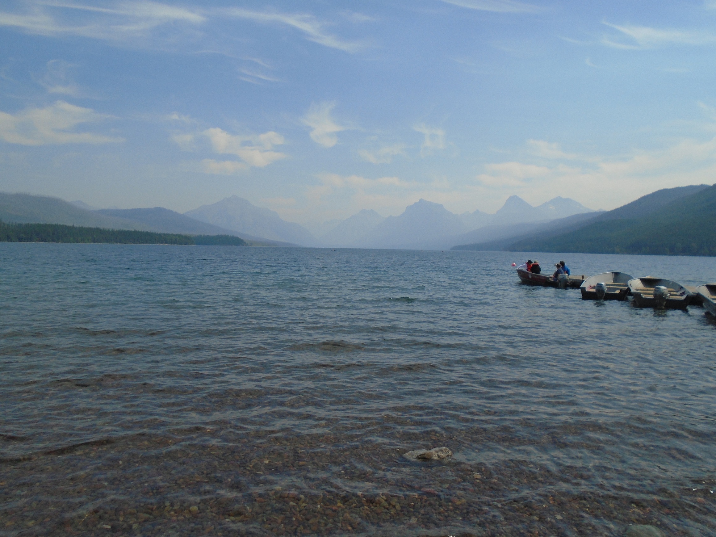
We started the tour by driving up highway 2 to the west entrance of the park and the beginning of the Going-to-the-Sun road at Lake McDonald. When you walk up to the lake you are greeted with a stunning view of its multi-colored rocks, clear water, and backdrop of many mountain peaks. According to Wikipedia, Lake McDonald is approximately 10 miles long and 472 feet deep, the largest lake in the park. Grizzly bears, black bear, moose, and mule deer are most common on the north shore. Lake McDonald Lodge mimics swiss architecture and the restaurant has tables by windows with a view. The lobby is three stories high and there is a large fireplace with Indian languages carved into it.
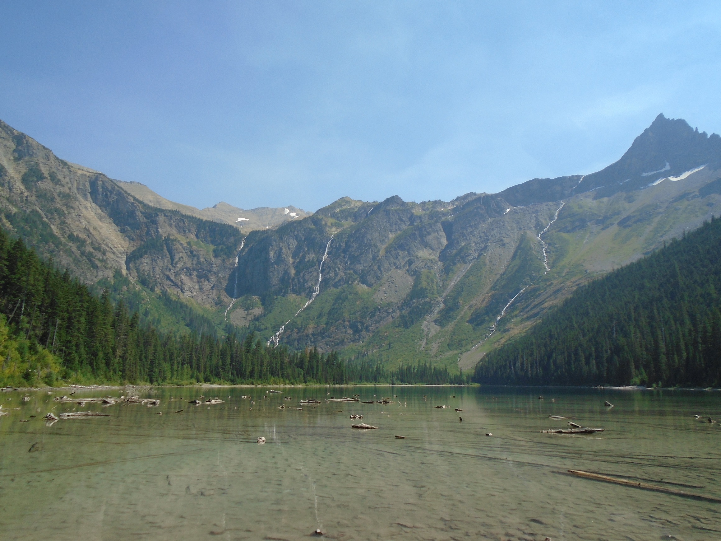
My niece wanted me to see the majestic Avalanche Lake and it did not disappoint. It is part of the Trail of the Cedars trail which is wheelchair accessible. Hiking the branch that led to Avalanche Lake was decidedly not accessible and I was the slow caboose hiking up the trail due to altitude, lunch, and let’s face it, age. But I made the two-mile hike which ended at a shallow lake surrounded by mountains. Four waterfalls poured down from the ice melt into the lake. In addition to the incredible view, there were also people in wedding clothes posing for pictures and the worst smelling pit toilet I have even encountered in my life. You never can tell what you will find out in the world.
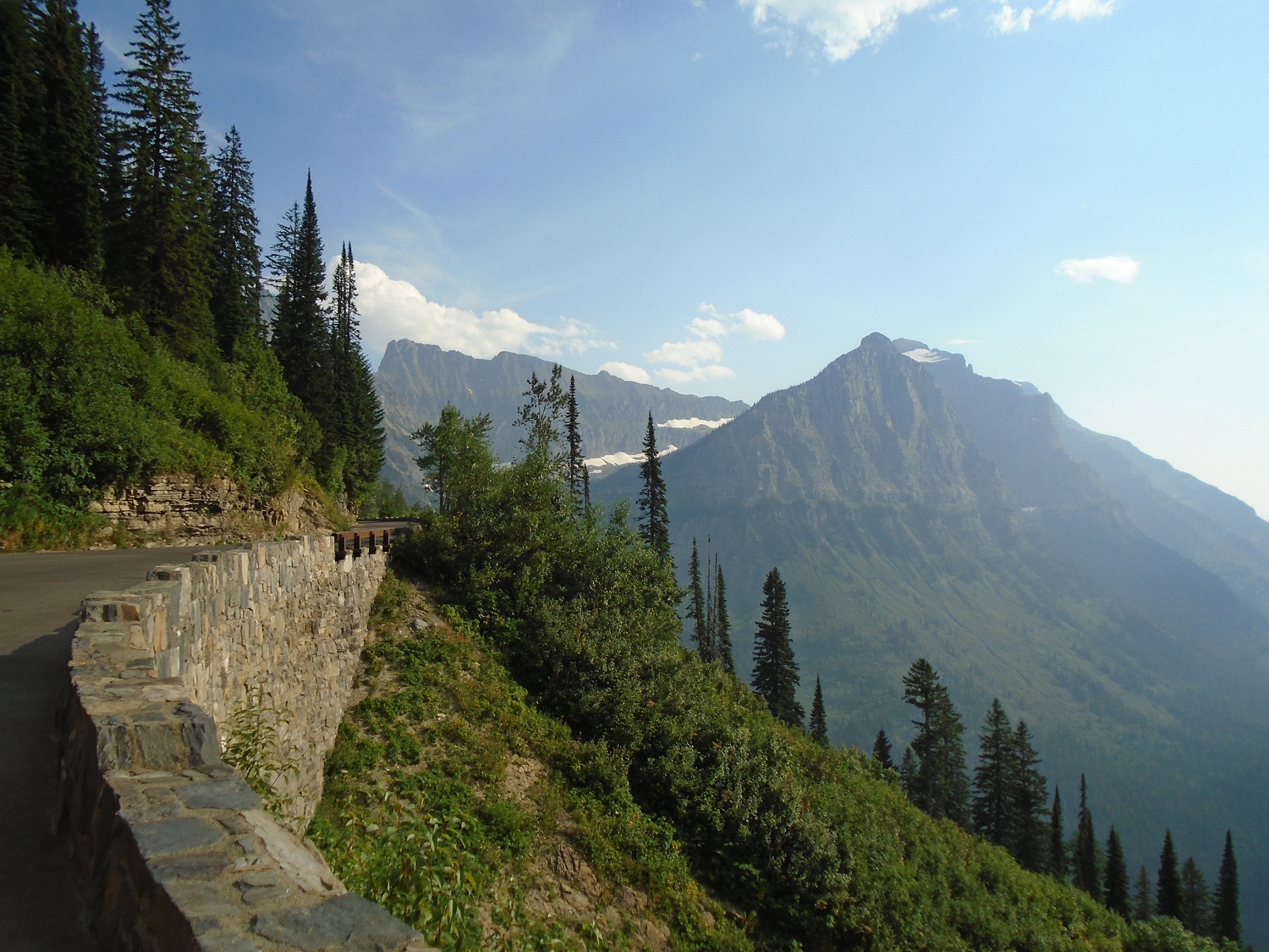
After being completely and pathetically whipped out by the Avalanche Lake trail, my niece drove us along the Going-to-the-Sun road which has got to be the king of scenic overlooks. According to Wikipedia, the Sun Road is the only road that traverses the park crossing the Continental Divide through Logan Pass at an elevation of 6,646 feet, the highest point on the road. Constructed between 1921 and 1932, the length of the road is approximately 50 miles and spans the width of the park between the east and west entrance stations.
The road is one of the most difficult roads in North America to snowplow in the spring. Up to 80 feet of snow can lie on top of Logan Pass, and more just east of the pass where the deepest snowfield has long been referred to as the Big Drift. The road takes about ten weeks to plow, even with equipment that can move 4,000 tons of snow in an hour. On the east side of the Continental Divide, there are few guardrails due to heavy snows and the resultant late winter avalanches that have repeatedly destroyed every protective barrier ever constructed.
I am sad to report that the park experienced a massive wildfire this summer after my visit. Due to the fire, Going-to-the-Sun Road closed on the west side between the foot of Lake McDonald and Logan Pass. According to Wikipedia, the Sprague Fire started due to a lightning storm, encompassed 16,982 acres, and destroyed the historical Sperry Chalet.
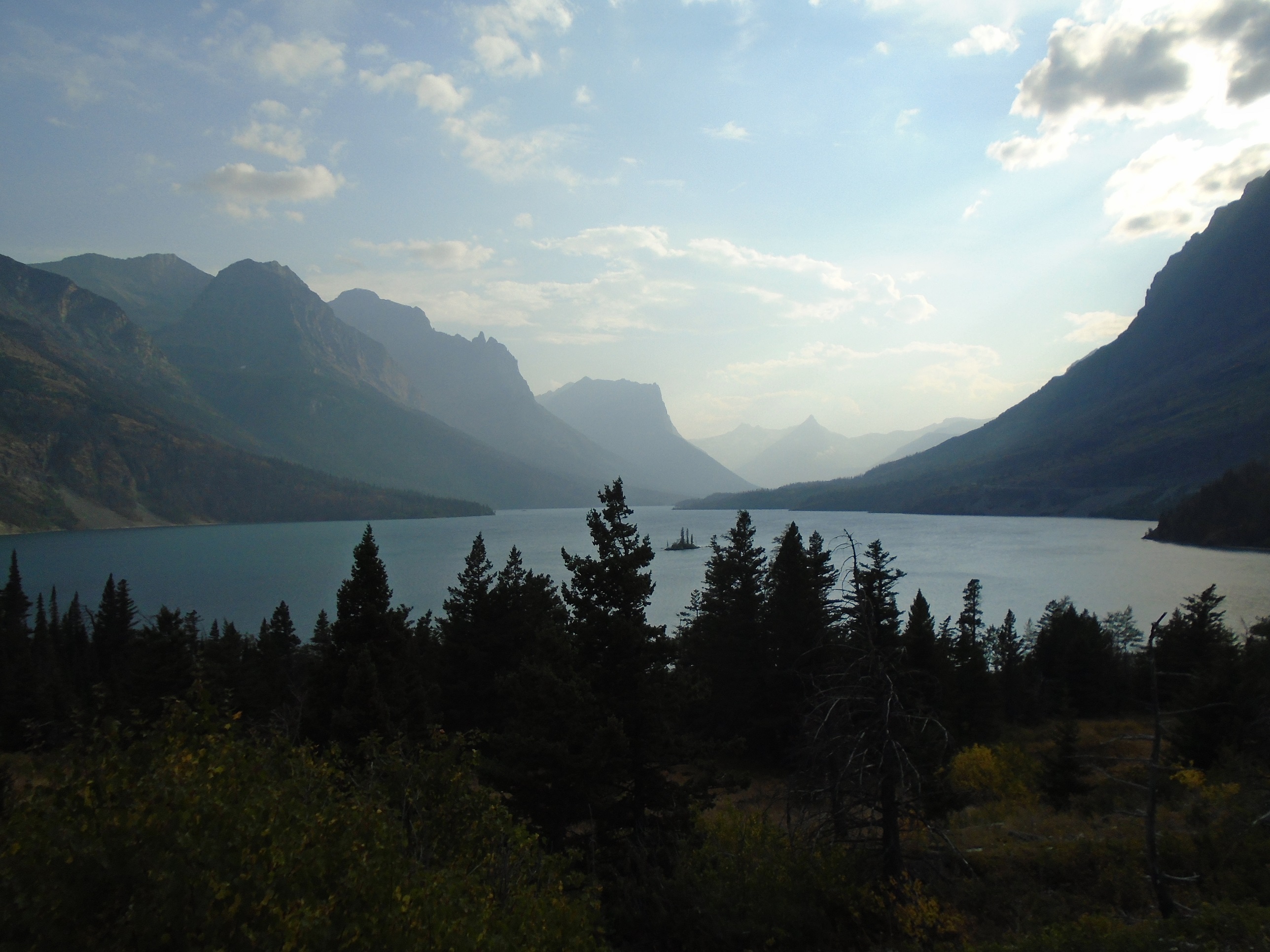
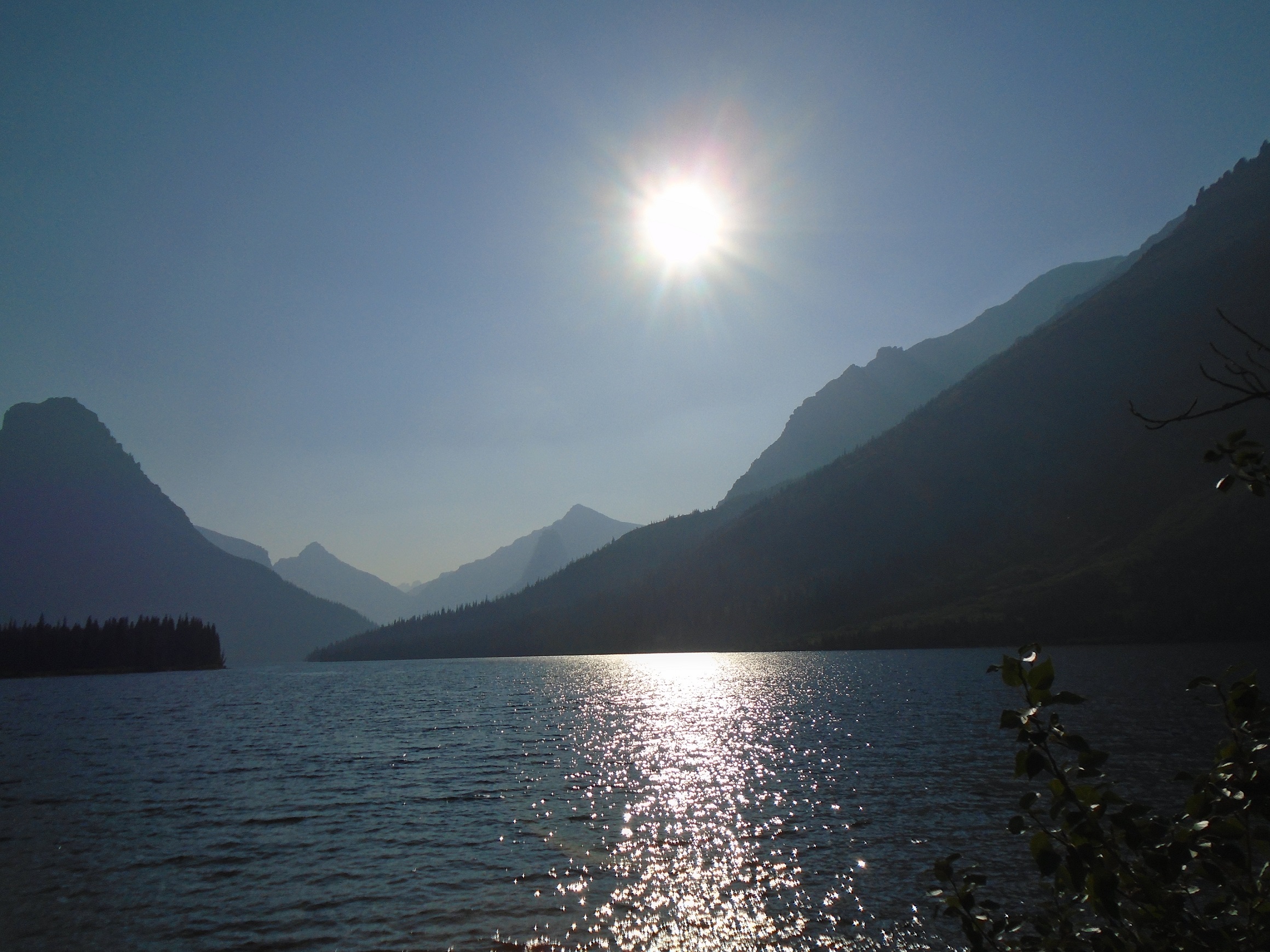
Going-to-the-Sun road ends at the majestic Saint Mary Lake. According to Wikipedia, it is the second largest lake in the park at 9.9 miles long and 300 feet deep. Saint Mary lake is 1,500 feet higher in altitude than Lake McDonald and during the winter is often completely frozen over with ice up to 4 feet thick. The opening scene of the film The Shining was shot at Saint Mary Lake. I found it impossibly beautiful, a place where the mountains appeared to melt into the lake. We arrived late in the day and were treated to the western sun casting soft light behind the mountains. We ate dinner at the St. Mary lodge and on the trip back to my cabin, I fell asleep in the car. Thankfully, I was not driving.
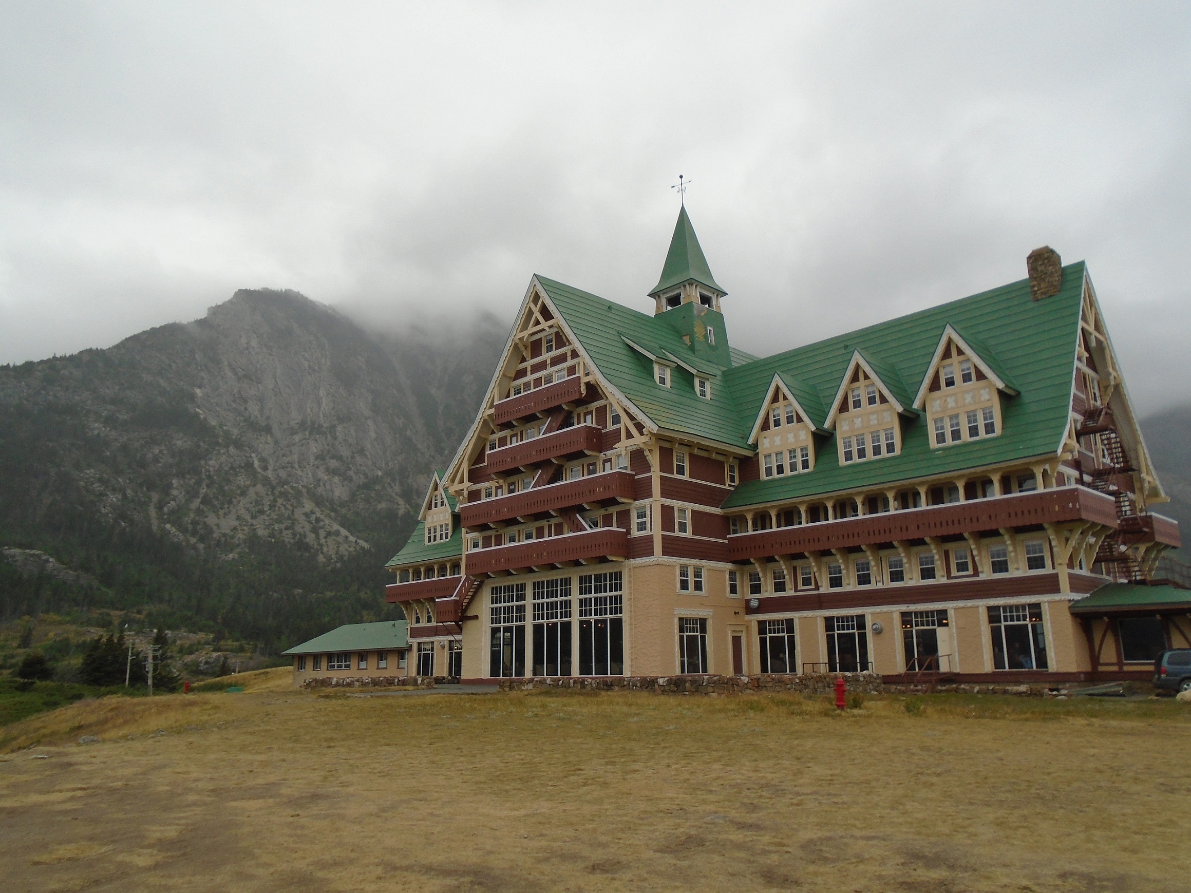
My second day in the park was dreary so we decided to delay the big hike another day. To be frank, driving to Canada and eating were about all I had left in me. The national park system crosses the border to create the Waterton-Glacier International Peace Park. Waterton Lakes National Park is the Canadian companion to Glacier National Park. We ate lunch at the impressive Prince of Wales Hotel. According to Wikipedia, it is a historic railroad hotel overlooking Upper Waterton Lake and was constructed between 1926 and 1927, by the Great Northern Railway of the U.S. to lure tourists during the prohibition era.
I am sad to report that after my visit, the Kenow Fire destroyed 30% of Waterton Lakes National Park including the visitors center where we had stopped for information. But as the Canadian park service says, “New growth sprouts from the roots of burned shrubs. Flowers bloom and grasslands are reborn. Animals forage in the lush new growth. Over time, fires create a patchwork of burned and unburned vegetation. This diverse mix of habitats is favoured by wildlife and supports many species.”
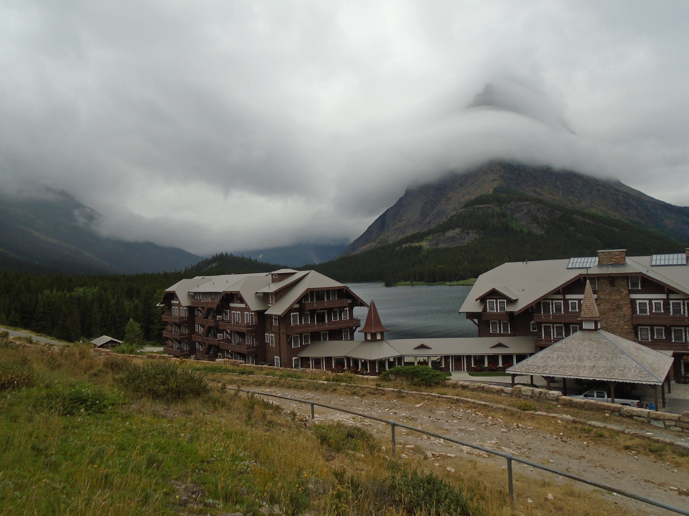
We stopped by the Many Glacier lodge which is the largest lodge in the park and built in 1914 on Swiftcurrent lake. There are several glaciers here as the Many Glacier name suggests and scenic boat tours are available. According to Wikipedia, nearby Grinnell Glacier is one of the most photographed glaciers in the park and many of these photographs date back to the mid-19th century. When compared with images taken over subsequent years, the glacier has obviously retreated substantially. Between 1966 and 2005, Grinnell Glacier lost almost 40 percent of its acreage. Glaciologists have predicted that if carbon dioxide levels increase at a worst-case scenario, all the glaciers in the park, including Grinnell, will disappear by the year 2030.
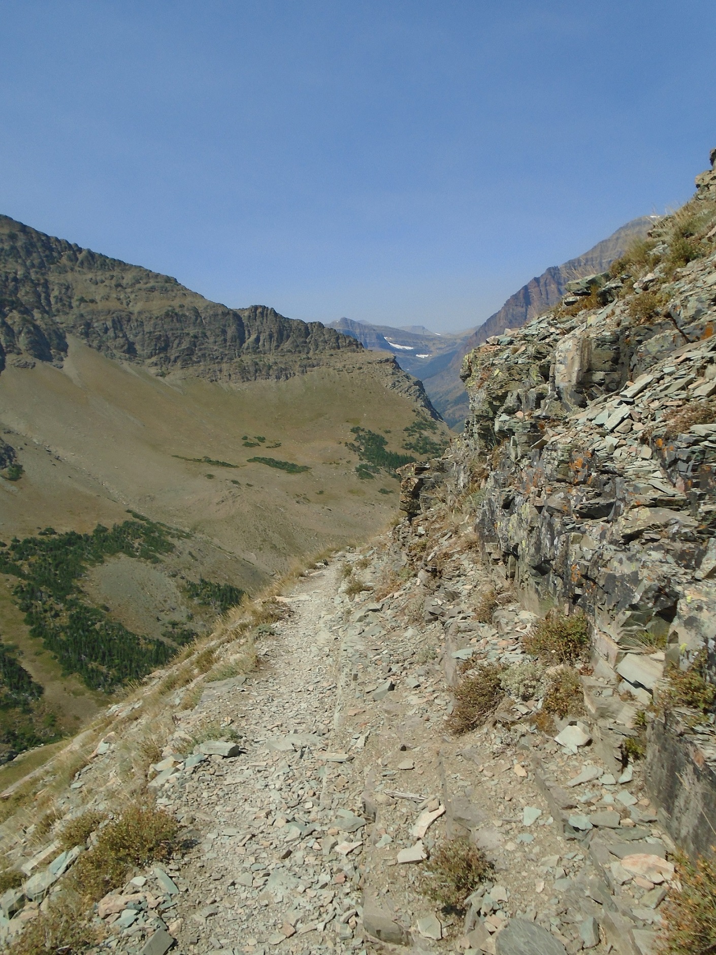
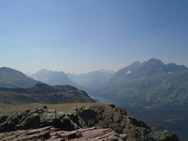
My third day, we swallowed the whole enchilada and hiked Scenic Point trail up Mt. Henry. This hike is not for the faint of heart. There were moments on this climb that I had such vertigo that I had to stare at the mountain face, not the beautiful view below us. The trail at times seems only as wide as your shoulders and is a steep climb for a novice like me. There was no shade because we foolishly went after lunch. There is no bathroom except where you squat on the mountain and the only water is what you bring with you. I contended with fear of falling and bears, heat exhaustion, and blood sugar levels but because I have trained in the past for long distance summer cycling, I was able to manage all that and regulate my body. Again, I was the middle-aged caboose to my twenty-something niece but I made it! And oh, what a view! You can see the picture I took at the very top of this blog post.
According to hikinginglacier.com, the trail is eight miles round trip, with a total elevation gain of 2,300ft, and has a trail difficulty rating of strenuous. There are roughly sixteen switchbacks that you have to ascend before reaching scenic point and they seem to go on and on and on and on…
Scenic Point Trail overlooks Two Medicine, the collective name of a region located in the southeastern section of Glacier National Park. According to Wikipedia, the region was considered sacred ground by several Native American tribes including the Blackfeet and they performed Vision quests here. Aside from Chief Mountain, the Two Medicine area is the most sacred section of the park to the Blackfeet.
The Two Medicine Store built in 1914 on Two Medicine Lake is another one of five sites in the Great Northern Railway Buildings National Historic Landmark. After seven hours of hiking Mt. Henry, we bought some beer at the store and sat on a fallen tree limb watching mothers swim with their children. I felt as if I had cycled a century ride (100 miles in under 12 hours). A bottle of beer never tasted so good.
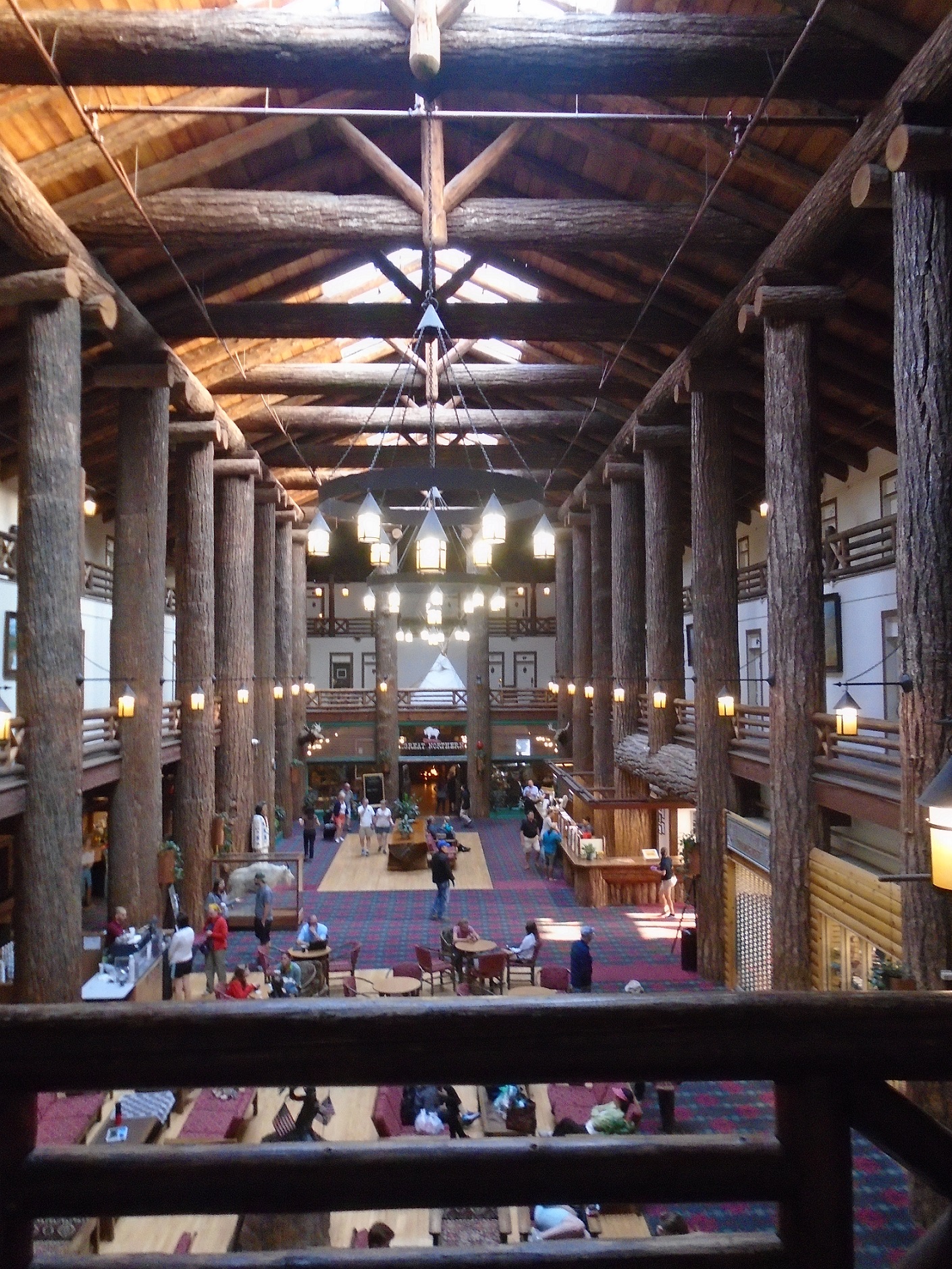
My last night I stayed at Glacier Park Lodge, the king of the lodges in the park and the place my niece and her husband worked for the summer season. If you are on a budget, this is not the hotel for you but I splurged for one night because let’s face it, they don’t build them like they used to. According to Wikipedia, the lodge was built in 1913 by the Great Northern Railway. The lodge is located at the foot of the Rocky Mountain Front and is a natural stopping place for visitors to Glacier. It is directly opposite and within walking distance of the railroad depot. The lodge is built around a three-story lobby lined with 40 feet tall Douglas-fir columns. Each column was brought in by rail from the Pacific Northwest because trees in Montana rarely grow so large. A total of 60 such trees were used and the lodge was loosely styled as a Swiss chalet fitting with the marketing of the park as the “American Alps”.
Like all things, my visit came to its end and I had to face the reality of driving home to my normal day-to-day life. It was an amazing adventure I am truly grateful to have the capacity to do these kinds of trips, both physically and financially. I still had to make the drive from Montana to Minnesota but I felt ready to go home. I was exhausted but renewed with the excitement of possibility. This is what stepping outside of your comfort zone can do for you. There is life out there in this great wide world of ours. You just have to be willing to go find it.
-Copyright C.M. Mounts, October 2017
Also See:
Great American Road Trip- Part 1
Great American Road Trip- Part 2
Great American Road Trip- Part 3
Great American Road Trip- Part 4
Great American Road Trip- Part 5
Great American Road Trip- Part 6
Great American Road Trip- Part 8

Pingback: Great American Road Trip- Part 6 | Working Schlub